INDEX
1745
GLOBAL MURALS
BARON COURTS
ARTS FESTIVAL
GOTHENBURG
FOWLERS
Search
Site
News
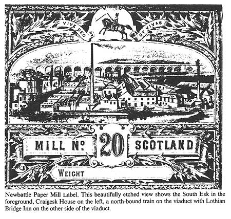
The Dean Tavern - A Gothenburg Experiment
Photographs and Illustrations
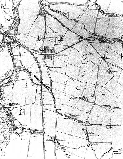
The first Ordnance Survey map of the district, showing the village of Newton Grange in 1854. The Colliery School is to the south. Further to the south is the Saughs where a creelmaker called Sandy Peacock lived.
Back
Next
Cover
-
Contents
-
Foreword
-
Introduction
-
Appendices
-
Photographs & Illustrations
Back
Back to top